Revolutionize Navigation: Google Maps Unlocks Sharper Satellite Imagery and Enhanced Street View Capabilities
Google Maps and Earth Get Major Upgrades
Sharper Satellite Imagery and More Street View Content
Google Maps is getting a major facelift, with sharper satellite imagery and more Street View content. Google Earth, on the other hand, will soon allow users to access more historical imagery.
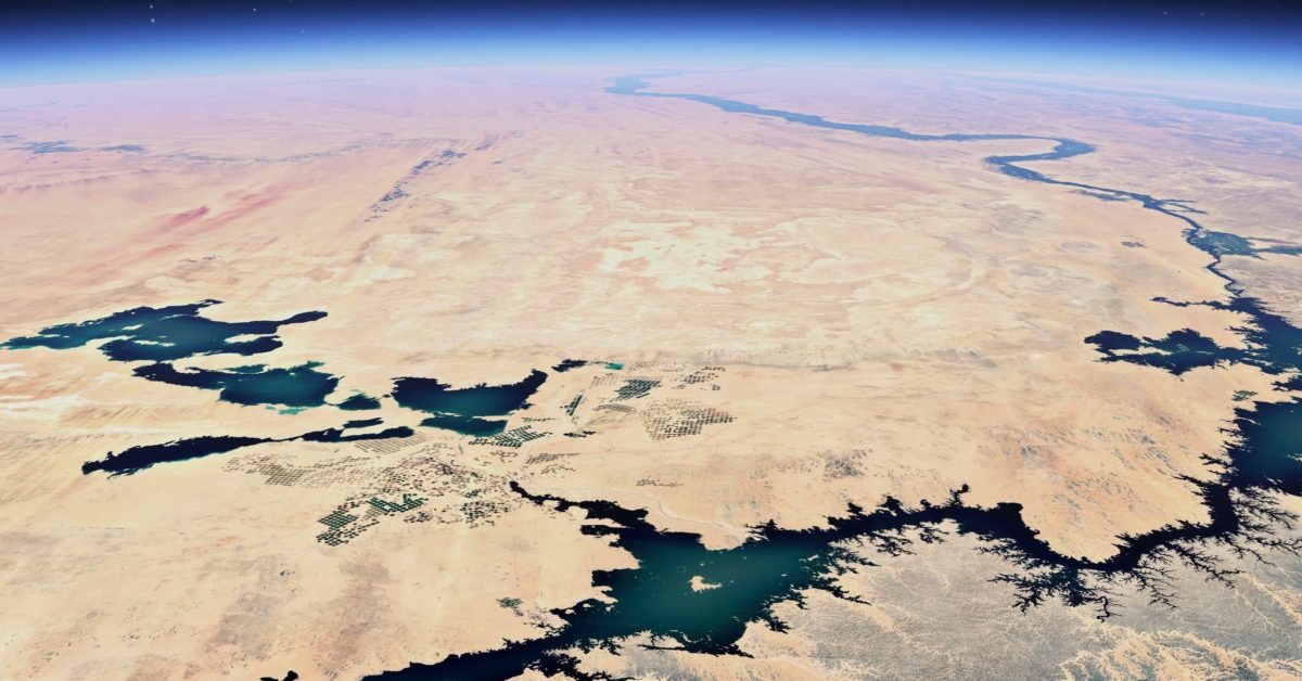
Starting this week, Google is introducing sharper satellite imagery across Maps and Earth by leveraging its Cloud Score+ AI model, which can recognize and remove clouds, cloud shadows, haze, and mist. This results in a “brighter, more vibrant globe” for a “clearer, more accurate look at Earth.”
Check out the example above, which shows Egypt’s Toshka Lakes with Cloud Score+.
Street View Expands to New Countries
Google is also launching one of the biggest updates to Street View, with new imagery in nearly 80 countries. This includes new imagery in countries like Australia, Argentina, Brazil, Costa Rica, Denmark, France, Iceland, Japan, Mexico, New Zealand, Philippines, Rwanda, Serbia, Spain, South Africa, Switzerland, and Uruguay. Additionally, Street View is launching in Bosnia, Namibia, Liechtenstein, and Paraguay for the first time.
Google Earth Gets Historical Imagery
Finally, Google Earth is getting new historical (satellite and aerial) imagery, which spans up to 80 years on web and mobile. This includes examples like the black-and-white photo of San Francisco in 1938, taken by Oakland Airport pilots. Check out the video below to see how San Francisco has changed over the years.
More on Google Maps:
Google Maps is getting sharper satellite imagery and more Street View content, making it easier to explore the world like never before.